Lowering criteria for warnings and advisories of heavy rain and flooding in the earthquake affected area |
|
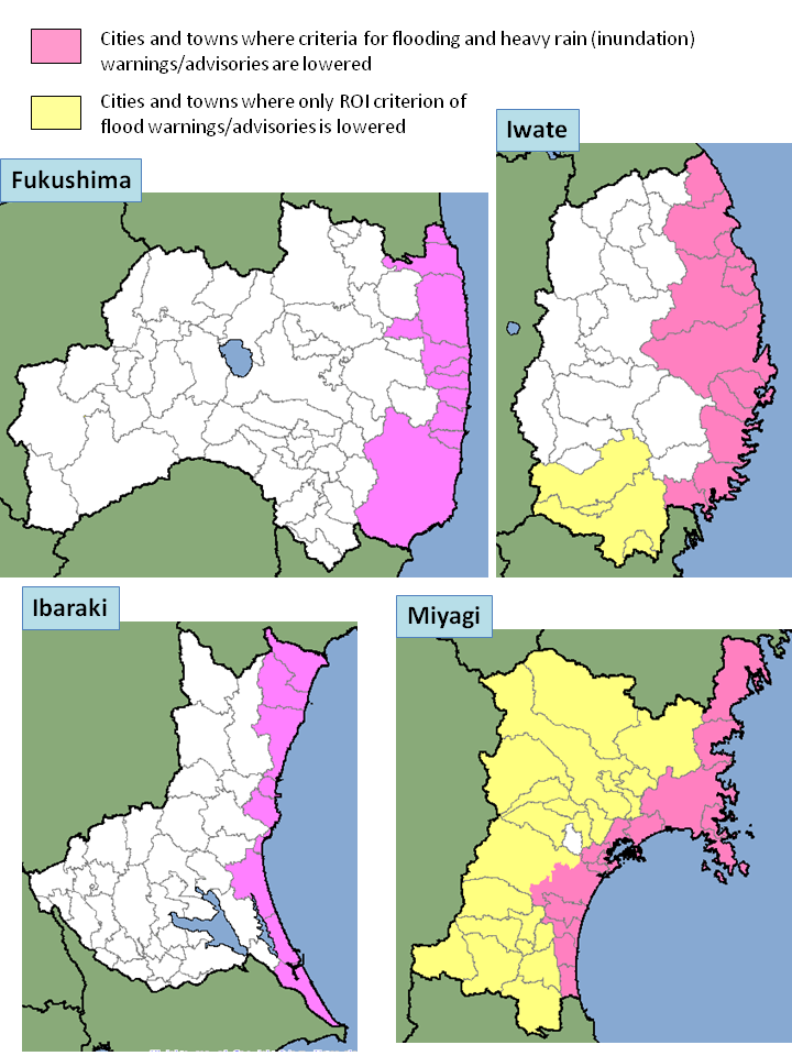
The Japan Meteorological Agency (JMA) tentatively changes the criteria for warnings and advisories of heavy rain and flooding in the affected areas in the 2011 Great East Japan Earthquake and the following tsunami. In the earthquake affected areas, the risk of flooding and inundation is expected to be higher than usual due to damages to embankments and drainage facilities caused by quakes and tsunami. As part of its disaster risk reduction schema, JMA tentatively lowers the criteria for warnings and advisories when such a massive natural disaster occurs. In this case, JMA decided to lower the criteria of the Runoff Index (RI) and rainfall amount used for the warnings and advisories of heavy rain and flooding in the affected areas (colored in the map below) for the time being. See Table 1 for the tentative criteria and the target area. Table 1 - Tentative criteria and target area
Table 2 - Cities and towns where criteria of flooding and heavy rain (inundation) warnings/advisories are lowered (Red in the map)
Table 3 - Cities and towns where only RI criterion of flood warnings/advisories is lowered.
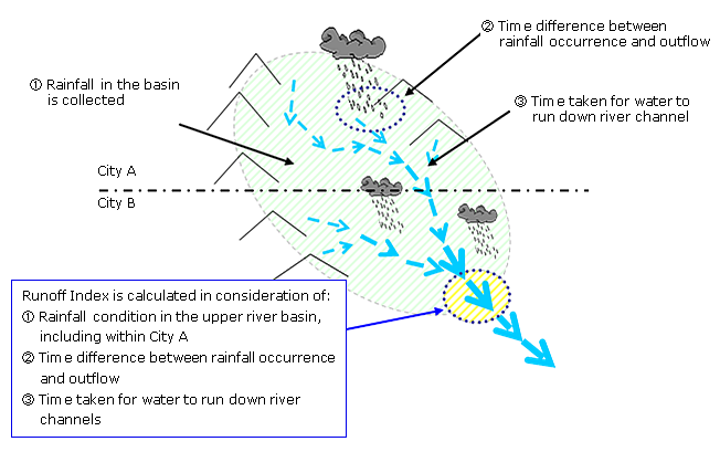
Runoff Index
The Runoff Index (RI) is an index to describe how the rainwater falling into the river could impact the downriver areas. RI is calculated on the basis of the runoff and flow processes, taking into account the amount of rain which has already fallen (precipitation analysis) and that of expected rainfall in the next few hours (very short range forecast of precipitation). RI well reflects the time gap between the rainfall and flowout, and time taken for water to flow from upstream to downstream areas. JMA uses RI and Soil Water Index (SWI) in addition to the analyzed rainfall as the criteria for warnings and advisories of heavy rain and floods. 
|
|
- Back to the top page of News releases |