MTSAT-1R and MTSAT-2 have functions to observe not only full earth and hemisphere but also limited particular area by rapid repetition scanning. Different from spinner satellites such as previous GMS series, three-axis control system enables MTSAT to make its imagers point to the earth all the time.
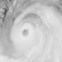
JMA has successfully obtained detailed images of Typhoon T0601 (CHANCHU) structure by MTSAT-2 as a part of in-orbit test on 15 May 2006. The observed area was square of about 1,000km longitudinally and latitudinally, and time interval is about 1 minute.
The figures and animations available below show the Typhoon's meso-scale structures such as detailed cloud system of eye-wall, cumulus convections genesis, rain bands and the wind shear in lower to middle layer of the troposphere around the Typhoon.
It is expected to, by using this observing function of MTSAT, make progress in investigations and understandings of the mechanisms of typhoons and severe storms. It is also expected to contribute to international observation research programmes such as THORPEX*, as one of the targeting observation methods.
| A research observation of Typhoon T0601 (CHANCHU), 2006 | ||
|---|---|---|
| Conditions of observation | Animation of rapid scan imagery | Normal visible image at the same time |
| Observation date 15 May 2006 Observation time 0402 UTC to 0517 UTC Image Visible Time interval / frequency Per 64 seconds / 64 sampling Area 1,000 km squared |
 Note: this is a video file in avi format (8.0 MB); to download Windows Media Player is required. Visit the Windows Media Player website |
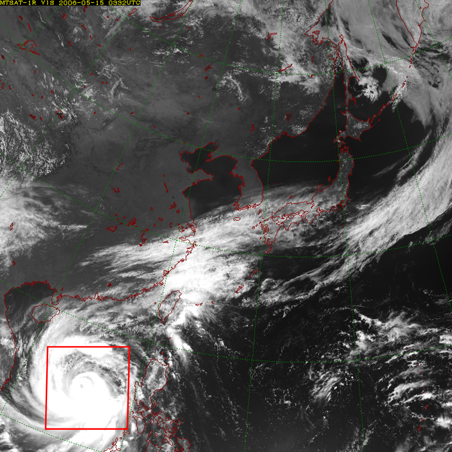 click image to enlarge *The red square shows the area of targeting observation |
| References Status of the Typhoon (0300 UTC) Pressure at the center : 930hPa Location : 14.4 degrees North latitude, 115.4 degrees East longitude |
||