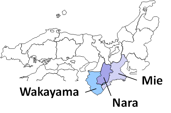
Typhoon Talas making landfall on Shikoku brought heavy rain and strong wind nationwide. Tokai and Kinki Districts (especially Mie, Nara and Wakayama Prefectures) sufferred from the record-braking rainfall from 30 August.
The risk of sediment disaster is still much higher in the typhoon affected area. The most careful attention is still needed to the sediment disaster and secondary disasters induced by future rainfall.
As a part of Japan's Government, the Japan Meteorological Agency (JMA) has provided weather forecast, warning/advisory as well as tropical cyclone information to prevent the secondary disaster. As well as the domestic information provision, RSMC Tokyo - Typhoon Center in JMA has provided tropical cyclone information internationally.
Talas (1112) formed as a tropical depression over the sea west of the Mariana Islands on 24 August 2011, and it moved slowly northward and developed into a Typhoon on 30 August. On 3 September, Talas made landfall on Shikoku Island and reached the Sea of Japan on the next day after crossing Shikoku and Chugoku regions.
Because Talas had a large scale strong wind area and moved very slowly, it induced moisture advection for many hours and caused the record-breaking heavy rainfall over a wide area from western to northern Japan, especially along the mountains.
Especially over a wide area of the Kii Peninsula (Kii Hanto), the total amount of the precipitation from 17 JST, 30 August exceeded 1,000 mm. The observing station at Kamikitayama-village in Nara Prefecture observed 1,652.5 mm rainfall in 72 hours, hitting the record high in Japan. The total amount of the precipitation at the station reached 1805.5 mm and precipitation amount in some areas was estimated to be over 2,000 mm based on Radar/Raingauge Analyzed Precipitation.
This record-breaking heavy rainfall brought by Typhoon Talas caused sediment disasters, inundation and river flooding that claimed many casualties and missing mainly in Wakayama, Nara and Mie Prefectures. In addition, substantial property damage including house damage such as inundation above floor level and agricultural damage such as submergence of rice fields, and damage to the transportation such as cancellation of trains were reported in a wide area from Hokkaido to Shikoku.
Observation
- Radar observation (about 4MB)
Composite weather radar echoes are displayed from 9:00 JST, 1 September to 19:00 JST, 4 September, every 30 minutes.
- Meteorological satellite observation
Satellite (MTSAT-2) infrared imageries are displayed from 9:00 JST, 30 August to 8:30 JST, 6 September.