Numerical Weather Prediction Activities
As a pioneer among Numerical Weather Prediction (NWP) centers, JMA has actively developed its suite of NWP systems since such prediction was begun in 1959. As a globally contributor to the field, the Agency today outputs a variety of NWP products to support National Meteorological and Hydrological Services (NMHSs) in the provision of effective and efficient services.
JMA's NWP Strategic Plan Toward 2030
Meteorological Operation Focusing on Science and Technology Toward 2030 (a recommendation formulated by the Meteorological Subcommittee under the Council of Transport Policy implemented by Japan’s Ministry of Land, Infrastructure, Transport and Tourism) is intended to help prevent and mitigate natural disasters and improve socioeconomic productivity. Based on the direction suggested in this recommendation, JMA’s NWP Strategic Plan Toward 2030 actively promotes steady technical development in numerical weather prediction as part of social information infrastructure in disaster prevention and related fields.
Numerical Weather Prediction Models and related Application
JMA currently operates the following NWP models:
- The Local Forecast Model (LFM) for aviation forecasts, weather warnings/advisories and very short-range forecasts of precipitation for Japan and its environs, providing 18 and 10-hour forecasts every hour
- The Local Ensemble Prediction System (LEPS) based on a 2-km-resolution version of the LFM for estimation of LFM prediction uncertainty, providing 21-hour forecasts every 6 hours
- The Meso-Scale Model (MSM) for weather warnings/advisories, very short-range forecasts of precipitation and aviation forecasts covering Japan and its environs, providing 78 and 39-hour forecasts every 3 hours
- The Meso-scale Ensemble Prediction System (MEPS) with the same configuration as the MSM for estimation of MSM prediction uncertainty, providing 39-hour forecasts every 6 hours
- The Global Spectral Model (GSM) for tropical cyclone information, daily forecasts and one-week forecasts up to 11 days ahead covering the entire globe
- The Global Ensemble Prediction System (GEPS) based on a low-resolution version of the GSM for tropical cyclone information, one-week forecasts, two-week temperature forecasts and early warning information on extreme weather
- An ensemble prediction system based on an atmosphere-ocean coupled model for one-month forecasts, three-month forecasts, warm-season outlooks, cold-season outlooks and El Niño outlooks
- Other NWP models for specific targets such as ocean waves and sea ice extents
JMA also uses NWP models in relation to atmospheric environmental issues, as exemplified by its Regional Specialized Meteorological Center (RSMC) work under the framework of
WMO's Emergency Response Activities (ERA) programme for environmental emergency response activities in Asia. The Center provides NMHSs with outlooks on the diffusion and deposition of hazardous materials based on JMA's Atmospheric Transport Model in the event of the accidental release of such materials from nuclear facilities.
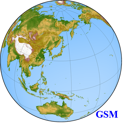
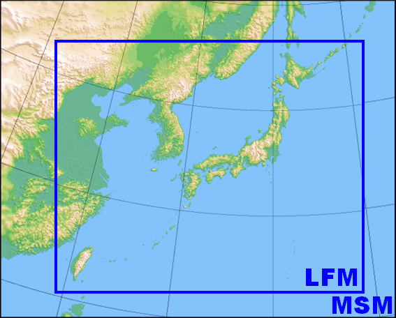
Domains of JMA's NWP models
Specifications of JMA's NWP models
|
Local Forecast Model (LFM) |
Local Ensemble Prediction System (LEPS) |
Meso-Scale Model (MSM) |
Meso-scale Ensemble Prediction System (MEPS) |
Global Spectral Model (GSM) |
Global Ensemble Prediction System (GEPS) |
Seasonal Ensemble Prediction System |
| Purposes |
Weather warnings/advisories,
Very short-range forecasts of precipitation
and
Aviation forecasts |
Weather warnings/advisories |
Weather warnings/advisories,
Very short-range forecasts of precipitation
and
Aviation forecasts |
Weather warnings/advisories
and
Aviation forecasts |
Tropical cyclone information,
Daily forecasts
and
One-week forecasts |
Tropical cyclone information |
One-week forecasts |
Two-week temperature forecasts,
Early warning information on extreme weather |
One-month forecasts |
Three-month forecasts,
Warm-season outlooks,
Cold-season outlooks
and
El Niño outlooks |
| Forecast domain |
Japan and its environs |
Globe |
| Grid size and/or number of grids |
1 km/
3,161 x 2,601 |
2 km/
1,581 x 1,301 |
5 km/
817 x 661 |
0.1250 deg. (TQ959) |
0.25 deg. (TQ479) |
Atmosphere
0.5625 deg. (TL319)
Ocean
0.25 x 0.25 deg. |
| Vertical levels/Top |
76/21.8 km |
96/37.5 km |
128/0.01 hPa |
Atmosphere
128/0.01 hPa
Ocean
60 layers |
| Forecast range (Initial time)/number of ensemble members |
18 hours
(00, 03, 06, 09, 12, 15, 18, 21 UTC)
10 hours
(hourly except for the above) |
21 hours (00, 06, 12, 18 UTC)
21
members |
78 hours (00, 12 UTC)
39 hours (03, 06, 09, 15, 18, 21 UTC) |
39 hours (00, 06, 12, 18 UTC)
21
members |
5.5 days (06, 18 UTC)
11 days (00, 12 UTC) |
5.5 days (06, 18 UTC)*
51
members |
11 days (00, 12 UTC)
51
members |
18 days
(12 UTC)
51
members |
1 month (00 UTC; twice a week)
25
members |
7 months (00 UTC)
5
members |
| Initial condition |
Hybrid 3D-Var Analysis |
Hybrid 3D-Var Analysis with ensemble perturbations |
4D-Var Analysis |
4D-Var Analysis with ensemble perturbations |
Hybrid
4D-Var Analysis*** |
Global analysis with ensemble perturbations |
Global analysis and MOVE/MRI.COM-G3 with ensemble perturbations |
* Forecasts from initial times at 06 and 18 UTC are disseminated when any of the following conditions is satisfied at the initial times:(i) A tropical cyclone (TC) of tropical storm (TS**) intensity or higher is present in the RSMC Tokyo-Typhoon Center’s area of responsibility (0 - 60°N, 100°E - 180°);(ii) A TC is expected to reach TS intensity or higher in the area within the next 24 hours.
** A TS is defined as a TC with maximum sustained wind speeds of 34 knots or more and less than 48 knots.
*** Ensemble forecasts initialized with a Local Ensemble Transform Kalman Filter are used as part of background error covariances in 4D-Var.
Major Progress in NWP Systems
Local Forecast Model
In 2012, JMA began operating the Local Forecast Model (LFM) with a horizontal resolution of 2 km for eastern Japan every three hours. Particular focus was placed on creating nine-hour predictions for timely provision of fine-grid forecasts to support aeronautical operation, especially in the vicinity of Tokyo International Airport (Haneda).
In 2013, the LFM was modified to cover the whole of Japan and run every hour for more sophisticated meteorological forecasts to further support disaster risk reduction and safer flights over the nation.
In 2019, the range of forecast was extended from 9 to 10 hours for all 24 daily operations (every hour).
In 2021, the number of vertical layers was increased from 58 to 76.
In 2022, a hybrid method was incorporated into the operational local data assimilation system.
In 2024, the range of forecast runs at 00, 03, 06, 09, 12, 15, 18 and 21 UTC was extended from 10 to 18 hours.
In 2026, the horizontal resolution was enhanced from 2 to 1 km.
Local Ensemble Prediction System
In 2026, JMA began operating the Local Ensemble Prediction System (LEPS) for estimation of LFM prediction uncertainty, especially for torrential rain caused by stationary linear mesoscale convective systems. The LEPS has a horizontal resolution of 2 km and consists of 21 members including a control run, providing 21-hour forecasts every 6 hours.
Meso-Scale Model
In 2013, the forecast domain was enlarged and the range of forecast was extended to 39 hours for all eight daily operations (one every three hours).
In 2019, the range of forecast runs at 00 and 12 UTC was extended from 39 to 51 hours.
In 2020, a 4D-Var method based on JMA's nonhydrostatic ASUCA model was incorporated into the operational meso-scale data assimilation system.
In 2022, the number of vertical layers was increased from 76 to 96, raising the top level from 21.8 to 37.5km. In addition, the range of forecast runs at 00 and 12 UTC was extended from 51 to 78 hours.
Meso-Scale Ensemble Prediction System
In 2019, JMA began operating the Meso-Scale Ensemble Prediction System (MEPS) with a control run equal to MSM prediction, and perturbed runs with the same configuration as the MSM with 20 members.
In 2022, the number of vertical layers was increased from 76 to 96, raising the top level from 21.8 to 37.5 km.
Global Spectral Model and Ensemble Prediction Systems
In 2007, horizontal resolution was enhanced from 55 to 20 km for the Global Spectral Model (GSM) and from 110 to 55 km for the One-week Ensemble Prediction System. At the same time, the number of vertical layers was enhanced from 40 to 60 for both models.
In 2008, the Typhoon Ensemble Prediction System was put into operation.
In 2013, the range of the forecast runs at 12 UTC was extended from 216 to 264 hours for both the GSM and the One-week Ensemble Prediction System.
In 2014, JMA enhanced the horizontal resolution of the One-week Ensemble Prediction System from 55 to 40 km, and also increased the operation frequency and the number of ensemble members per day. The GSM was further enhanced by increasing the number of vertical layers from 60 to 100, raising the top level from 0.1 to 0.01 hPa and revising the physical processes involved. In addition, the Typhoon Ensemble Prediction System was upgraded by enhancing horizontal resolution from 55 to 40 km and the number of ensemble members from 11 to 25. The details of improvements implemented in 2014 are summarized in the
Joint WMO Technical Progress Report on the Global Data Processing and Forecasting System and Numerical Weather Prediction Research Activities for 2014.
In 2017, the Global Ensemble Prediction System (GEPS) was introduced as a unification of the Typhoon Ensemble Prediction System, the One-week Ensemble Prediction System and the One-month Ensemble Prediction System.
In 2018, the range of forecast runs at 00, 06 and 18 UTC was extended from 84 to 132 hours for the GSM.
In 2020, the range of forecast runs at 00 UTC was extended from 132 to 264 hours for the GSM.
In 2021, the number of vertical layers was increased from 100 to 128 for the GSM and the GEPS. In addition, the numbers of GEPS ensemble members per initial time were increased from 27 to 51 for 11-day forecasts, from 13 to 51 for two-week forecasts and from 13 to 25 for one-month forecasts. At the same time, the frequency of two-week and one-month forecasts was changed from twice a day (00, 12UTC) to once a day (12UTC).
In 2022, GEPS horizontal resolution was enhanced from 40 to 27 km for forecasts with lead time up to 18 days, and from 55 to 40 km for forecasts longer than 18 days.
In 2023, GSM horizontal resolution was enhanced from 20 to 13 km.
In 2026, GEPS provision of forecasts beyond 18 days ahead was ceased and its one-month forecast role was transferred to the Seasonal EPS.
Seasonal Ensemble Prediction System
In 2015, JMA updated its Seasonal Ensemble Prediction System. Changes included enhancement of the horizontal and vertical resolutions of the atmospheric model from 180 to 110 km and from 40 to 60 levels with the top level moved from 0.4 to 0.1 hPa, expansion of the target area to the whole globe in the oceanic model, and introduction of a sea-ice model.
In 2022, the Seasonal EPS was upgraded to the new JMA/MRI-CPS3 system. The horizontal resolution of the atmospheric model was enhanced from 110 to 55 km, and that of the ocean model was enhanced from 0.3–0.5 x 1.0 degrees to 0.25 x 0.25 degrees. The vertical resolution of the atmospheric model was also enhanced from 60 to 100 levels with the top level moved from 0.1 to 0.01 hPa, and that of the ocean model was enhanced from 52 layers and a bottom boundary layer to 60 levels. In addition, the ensemble size and running frequency of operational forecasting will be changed from 13 ensemble members every 5 days to 5 ensemble members every day.
In 2026, the Seasonal EPS was upgraded to the new JMA/MRI-CPS4 system. The vertical resolution of the atmospheric model was enhanced from 100 to 128 levels, and, starting with its role in one-month forecasts, the ensemble size was increased from 5 to 25 members with forecasts conducted twice a week and a forecast range of one month.